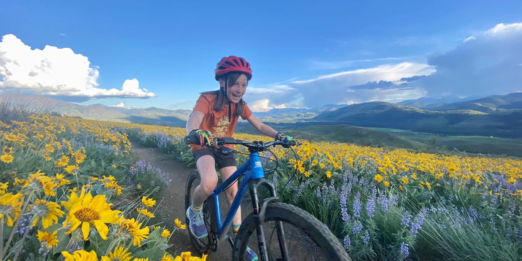
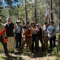
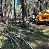
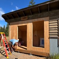
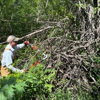
Methow Trails staff and volunteers have had a busy few months working on mowing, drainage issues, culvert replacements, logouts, brushing, and tread repair on trails throughout the system including the Methow Community Trail, Doe Canyon, Goat Creek, West Fawn, Jacks, River Run, Mazama trailhead, Big Valley, Radar Creek, Thompson Ridge, Cub Creek, Winthrop Trail, View Ridge, Patterson Lake, Rodeo, Beaver Pond, Heifer, Black Bear, Inside Passage, Pete's Dragon, Black Bear, Coal Creek, and many more!. The bike park at the Methow Trails HQ in Winthrop is in great shape. For trails further afield check out the Methow Valley Trail Collaborative's site for logout details and work party opportunities.
Huge thank you to the many hands who've contributed to the ongoing maintenance of all of these trails. And if you'd like to join a part of trail elves making magic out there, check out our website for a plethora of trail work opportunities, or make a donation to support ongoing maintenance of the trails.
Thank you to our land owners, land managers, community partners, volunteers, sponsors, and trail users. We are so appreciative of the collaborative work of so many passionate, caring, and skilled people. It's better together!
Rendez Vous+
| ABC | Distance | Open | |
|---|---|---|---|
Buck Mountain | 15.66km | ||
Buck Mountain FS Road | 4.44km | ||
Buck Up | 5.33km | ||
Cassal Creek Loop (black) | 0.75km | ||
Cassal Creek Loop (blue) | 1.72km | ||
Cassal Hut | 0.81km | ||
Cedar Creek Loop (black) | 1.87km | ||
Cedar Creek Loop (blue) | 4.14km | ||
Cougar Bait | 0.48km | ||
Cougar Mountain Loop | 4.64km | ||
Cow Creek | 4.23km | ||
Cub Creek | 3.47km | ||
Grizzly Hut | 0.5km | ||
Grizzly Mountain Loop | 1.59km | ||
Grizzly Way | 1.09km | ||
Gunn Ranch | 4.93km | ||
Heifer Hut | 1.26km | ||
Little Cub Creek | 5.22km | ||
Lower Rendezvous Basin | 1.48km | ||
Lower Rendezvous Pass | 2.57km | ||
Rendezvous Basin | 2.29km | ||
Rendezvous Pass | 1.12km | ||
Sick Joke Hill | 2.14km | ||
Upper Cougar Bait | 4.13km | ||
Upper Fawn Creek | 2.5km |
Sun Mountain+
| ABC | Distance | Open | |
|---|---|---|---|
Ain’t Never Nuthin | 1.11km | ||
Aqua Loop | 2.01km | ||
Beaver Pond | 2.29km | ||
Black Bear | 5.66km | ||
Blue Jay | 3.09km | ||
Cabin | 0.86km | ||
Chickadee | 1.1km | ||
Climb-it Change Lower | 2.33km | ||
Climb-it Change Upper | 3.04km | ||
Coal Creek Trail | 8.36km | ||
Corral | 1.64km | ||
Criss Cross | 1.1km | ||
Dave's Dive | 0.51km | ||
Herringbone Hill | 1.42km | ||
Homestead | 0.26km | ||
Horse | 0.93km | ||
Kraule | 2.02km | ||
Lakeview | 1.32km | ||
Little Wolf | 2.48km | ||
Little Wolf Connector | 0.12km | ||
Lower Cabin | 0.47km | ||
Lower Fox | 0.86km | ||
Lower Inside Passage | 1.42km | ||
Magpie | 0.74km | ||
Magpie Horse | 0.63km | ||
Meadow Lark | 6.31km | ||
Moose | 0.96km | ||
More Cowbell | 2.97km | ||
Overland | 1.52km | ||
Owl | 0.32km | ||
Patterson Lake | 2.41km | ||
Patterson North | 2.4km | ||
Patterson South | 2.01km | ||
Pete's Dragon | 4.33km | ||
Rader Creek | 2.31km | ||
Raven | 0.22km | ||
Rodeo | 2.61km | ||
Shortcut | 0.38km | ||
Sunnyside | 3.09km | ||
Thompson Pass | 1.48km | ||
Thompson Ridge | 22.74km | ||
Upper Fox | 0.75km | ||
Upper Inside Passage | 1.6km | ||
Upper Thompson Ridge | 2.39km | ||
View Ridge | 2.52km | ||
Wild Turkey | 1.82km | ||
Woodpecker | 7.71km | ||
Yellow Jacket | 1.88km | ||
Yellowjacket - Black Bear Connector | 1.18km | ||
Heifer | 0.6km |
Big Valley+
| ABC | Distance | Open | |
|---|---|---|---|
Big Valley (Inner Loop) | 2.43km | ||
Big Valley (Outer Loop) | 3.61km | ||
Forest Road 5130-100 | 1.95km | ||
Lewis Butte Trail | 7.68km | ||
Methow Community Trail- Wolf Ridge to Browns Farm | 2.66km | ||
National Forest Development Road 155 | 2.74km | ||
Rizeor Lake Trail | 6.22km |
Winthrop+
| ABC | Distance | Open | |
|---|---|---|---|
Fish Hatchery | 0.09km | ||
Meadowlark | 3.28km | ||
Methow Community Trail- Powers Plunge to Wolf Ridge | 1.5km | ||
Methow Community Trail- Winthrop to Powers Plunge | 0.84km | ||
Methow Valley Community Trail- Winthrop to Powers Plunge | 0.43km | ||
Powers Plunge | 2.02km | ||
Rex Derr Trail | 6.41km | ||
Susie Stephens Trail | 0.25km | ||
TWiN | 0.56km | ||
Winthrop Fatbike Snowshoe | 0.11km | ||
Winthrop Trail (Lower) | 3.29km | ||
Winthrop Trail (Upper) | 2.78km |
Mazama & River Run+
| ABC | Distance | Open | |
|---|---|---|---|
Cassal Cutoff | 0.79km | ||
Doe Canyon | 2.21km | ||
Doe Canyon Loop | 0.51km | ||
Early Winters | 0.59km | ||
Founders Trail | 4.29km | ||
Goat Creek | 2.61km | ||
Goat Creek Cutoff | 0.73km | ||
Inn Run Loop | 1.86km | ||
Jack's | 4.69km | ||
Lower Fawn Creek | 4.77km | ||
Lower River Run | 1.4km | ||
Lunachik | 1.6km | ||
Methow Community Trail- Browns Farm to Suspension Bridge Trailhead | 5.58km | ||
Methow Valley Community Trail- Browns Farm to Suspension Bridge Trailhead | 0.07km | ||
Methow Valley Community Trail- Mazama to Freestone Inn | 3.22km | ||
Sandy Butte | 1.76km | ||
Tawlk-Foster Suspension Bridge | 0.07km | ||
Upper Jack's | 2.5km | ||
Upper River Run | 3.8km | ||
Wolf Creek Road | 8.56km |